Showing posts with label California. Show all posts

Thursday, March 6, 2014

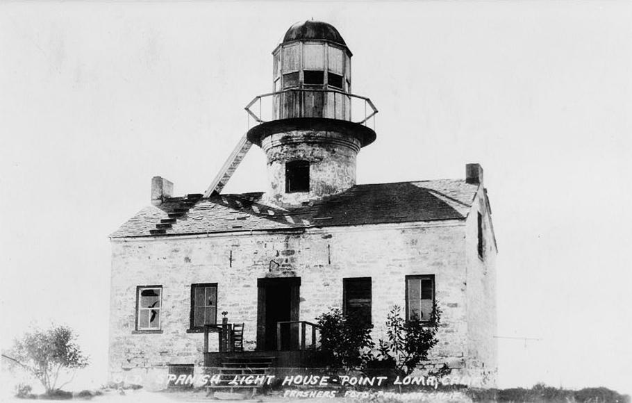
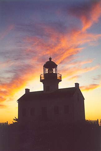
Old Point Loma, (Cabrillo) Light, San Diego Harbor, California

Know this one well, having visited it many times in San Diego.  


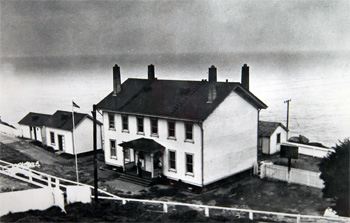
h the discovery of gold at Sutter's Mill in 1848, ship traffic greatly increased on the west coast, prompting the construction of several lighthouses. The Point Loma Lighthouse was one of the original eight west coast lighthouses, built under contract by the firm of Gibbons and Kelly from Baltimore. Six of the original eight, including the Point Loma Lighthouse, were built in the cape cod style, consisting of a one and a half story dwelling with a central, spiral staircase leading to the lantern room perched atop the structure.
The site selected for the lighthouse was the summit of Point Loma, a narrow finger of land forming the western boundary of San Diego's harbor and protecting it from the Pacific Ocean. On April 7, 1854, following the successful completion of lighthouses on Alcatraz Island, Fort Point and on the Farallon Islands, the schooner Vaquero finally arrived in San Diego with the necessary building supplies for the Point Loma Lighthouse. First, a road had to be constructed from the harbor to the top of the barren point. Sandstone for the dwelling was quarried on the point, while bricks were used to construct the tower and tiles from the ruins of the old Spanish Fort Guijarros were used for the basement floor. Water, needed for the mortar, had to be hauled from a well located seven miles from the site.
Buy at Art.com
Buy From Art.com
The lighthouse was completed by the end of August, 1854, but delays in acquiring a suitable lens would postpone its first lighting for over a year. The Point Loma Lighthouse was originally designed to house an Argand light, but before construction was completed, the Lighthouse Board had started to use the more efficient Fresnel lens, developed in France. The tower portion of the lighthouse had to be modified to house the Fresnel lens, and Harvey Ladd, who had arrived in San Diego a couple of years earlier with the Mormon Battalion, was hired as a mason for the rework. Finally, on November 15, 1855 the wicks of the lamp were lit, and the light from a third-order Fresnel lens shown out to sea for the first time. The cost of the lighthouse had grown from the contracted sum of $15,000 to almost $30,000.
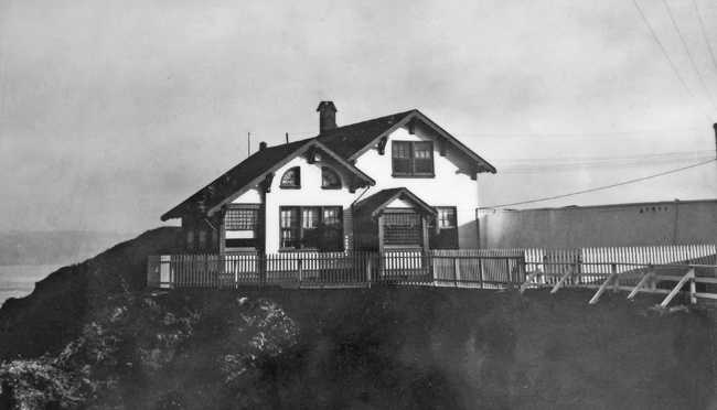
A principal keeper and an assistant were assigned to the station and had to share the four-room dwelling. In 1875, a barn was built near the lighthouse, and part of the oil and wood storehouse was converted into a two-room apartment for the assistant keeper. The sandstone walls of the lighthouse were left in a natural state, until by the 1870s deterioration was noted in the exposed stone. The southern and western walls, those most exposed to the onshore weather patterns, were covered with a heavy coat of cement-mortar followed by two coats of stone-colored paint. Later, all the walls would be covered, and in 1887 the lighthouse was given its now-familiar all-white look.
Acquiring sufficient water in the arid climate of San Diego was a problem for the early keepers. The basement of the lighthouse held a small cistern, which through a series of pipes, collected the rain that fell on the roof. This small supply was inadequate for the station, and the keepers were forced to travel seven miles one-way to fill large barrels at the nearest well. A large, concrete water catchment basin was built on the east side of the lighthouse, which fed into two subterranean cisterns. Still, in dry years, an occasional trip to the well necessary.
For many years, the lighthouse displayed a fixed white light, but with the growth of the city of San Diego other white lights were soon seen in the area and a more distinctive characteristic was needed. On April 1, 1889, the characteristic was changed to an alternating red and white flash with a one minute interval between flashes. Rather than replace the fixed lens, flash panels were placed inside the lens. The panels consisted of a pane of clear glass opposite a pane of red glass, and were rotated using weight driven clockworks.
At a height of 462 feet, Point Loma's light was the highest in the nation and was reportedly spotted by a ship thirty-nine miles at sea. This report must have actually been a reflection of the light from clouds as physics limits the distance at which a direct beam of light could be seen from Point Loma to under thirty miles. The light's lofty perch on the point meant it was often shrouded in fog, rendering it useless to mariners. In 1891, after just thirty-six years of service, Point Loma's light was extinguished, and the light from the newly constructed metal tower at the foot of Point Loma was first exhibited.
Robert Israel is the keeper most prominently associated with Point Loma. Originally from Pennsylvania, Robert joined the army during the Mexican War, and, after his service, settled in San Diego, where he married Maria Arcadia Machado de Alipas, a member of an old San Diego family. Keeper Israel served for twenty years at the Old Point Loma Lighthouse and during three of those years his wife served as Assistant Keeper. When the light of the old lighthouse was extinguished in 1891, the Israel family moved to the new lighthouse, where Robert served as keeper for one year, before quitting after an argument with authorities.
Old Point Loma Lighthouse
Photograph courtesy Library of Congress
After the lighthouse was deactivated, it soon fell into disrepair. Its windows were broken out, the lantern room’s metal roof was stripped off, and the basement was used as a comfort station. In 1913, the Order of Panama, a group dedicated to commemorating California’s Spanish heritage, proposed erecting a 150-foot-tall statue of Juan Rodriquez Cabrillo on Point Loma to honor his discovery of the area in 1542. The dilapidated lighthouse was to be torn down and replaced by the statue. The Order of Panama dissolved before the monument was realized. However, as a result of their plan, one-half acre around the lighthouse was set aside as Cabrillo National Monument by Presidential Proclamation.
Cabrillo National Monument was turned over to the National Park Service in 1933, and by 1935 the metal lantern room had been rebuilt and the lighthouse restored to its original condition. A concessionaire lived in the lighthouse, offering tours of the building and operating a tea room in southern room on the main floor. With the outbreak of war in 1941, gun batteries and submarine spotters were placed on Point Loma's strategic summit. The lighthouse was painted camouflage green during the war, and was used as a signal tower to direct ships into San Diego Harbor. Ships approaching the harbor flashed a code, which if correct caused the submarine nets stretched across the harbor's mouth to be lowered. After the war, the lighthouse was returned to the National Park Service.
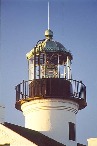
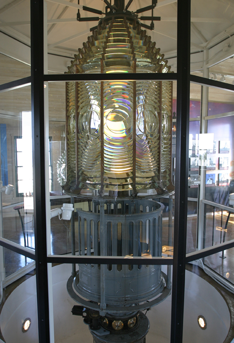
In the early 1980s, the lighthouse was meticulously restored and filled with period furnishings to resemble its state when Robert Israel locked the lighthouse door and moved his family to the new lighthouse. The lantern room currently houses the third-order lens from the Mile Rocks Lighthouse. The visitor's center at the monument has exhibits covering Cabrillo's discovery of San Diego Bay and local marine life. The area around the lighthouse offers excellent views of San Diego Bay, San Diego's skyline, and grey whales making their annual migration to and from Baja California.
In 2003-2004, the area around the lighthouse was significantly changed to more resemble its appearance when the Point Loma Lighthouse was in service. An assistant keeper's dwelling, which is now home to displays on the lighthouse along with the third-order Fresnel lens from the New Point Loma Lighthouse and the fourth-order lens from the Ballast Point Lighthouse, was constructed near the lighthouse where it originally stood. The cement water catchment basin, which funnels rainwater into the cistern, was also reconstructed on the slope east of the old lighthouse. These additions might distract some from the lighthouse, but they will help the visitor more fully understand a keeper's life during the late 1800s.

Point Bonita California

Another spot at GGNRA in California...


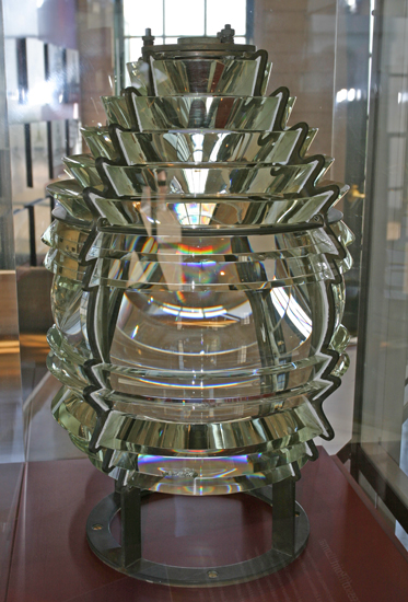
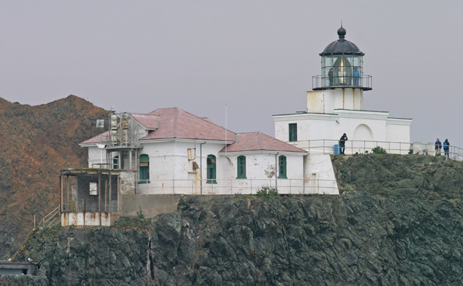
Guardian of the northern tip of the Golden Gate, the Point Bonita Lighthouse still uses its original second-order Fresnel lens to cast forth a guiding beacon for mariners.
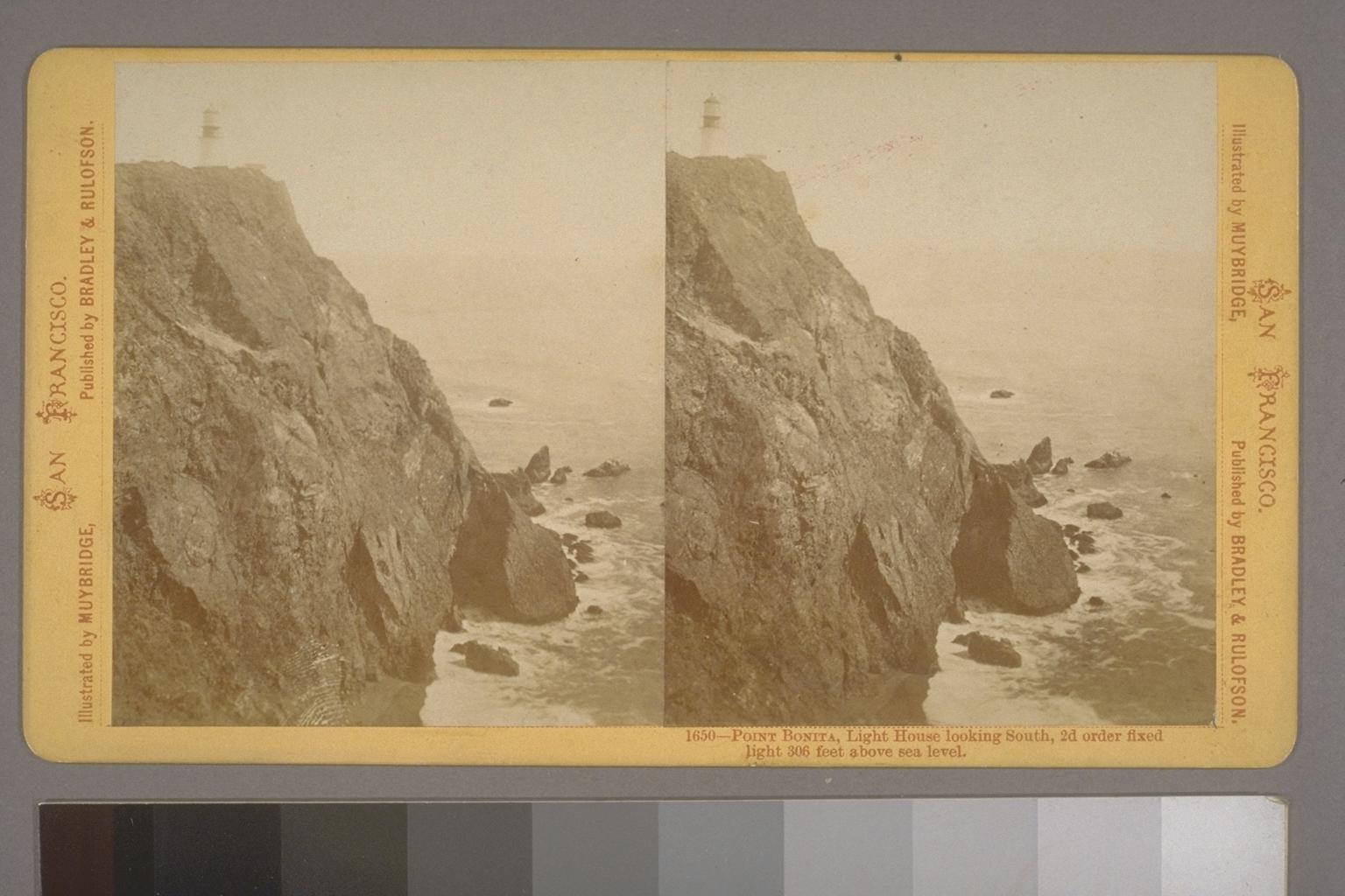
In the 1850s, as lighthouses started popping up along the West Coast, mariners cried for a light to mark the entrance of the Golden Gate whose recalcitrant currents, dangerous shoals, and incessant clinging fog had strangled the journey of many a vessel.
Buy at Art.com
Buy at Art.com
The Lighthouse Board originally designated Point Lobos, the south entrance of the Gate, as the location for a lighthouse, but local mariners fought the idea, arguing that the north side, Point Bonita, could be approached within 150 yards and would provide a safer entrance in rough weather.
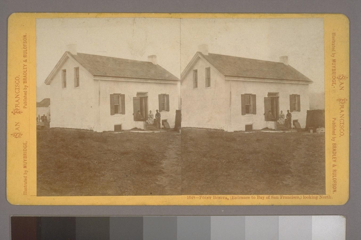
The Board again showed its ignorance of the Gate when it selected the highest hill at Point Bonita for the site of the lighthouse. California fog is characteristically a high fog, leaving lower elevations clear. The original lighthouse was a 56-foot, conical brick tower, situated 260 feet above the sea. A one-and-a-half-story brick and stone cottage was built near the tower, and the first keeper, Edward Colson, lit the lamp inside the lighthouse’s 2nd-order Fresnel lens for the first time on May 2, 1855.
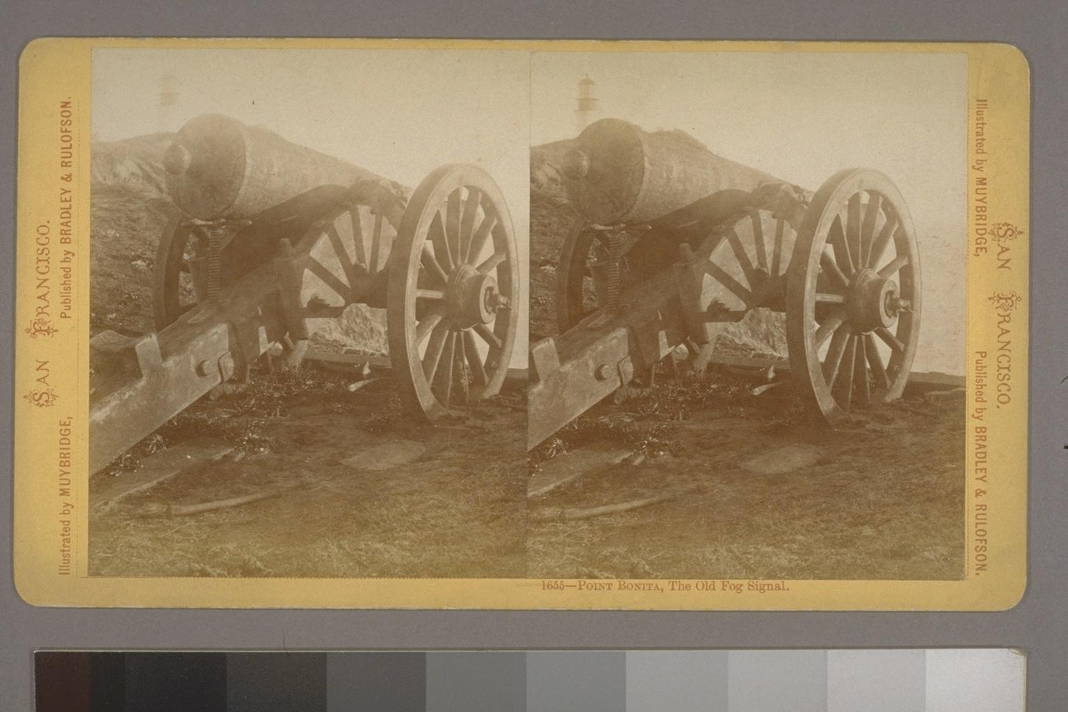
Quite often, the lighthouse was shrouded in fog, rendering it useless to seamen. To provide some sort of navigational aid in these conditions, an eight-foot-long cannon was acquired, and Edward Maloney, a retired army sergeant, was hired to fire it once every half-hour in times of fog starting on August 8, 1855. Just a few months later, Maloney sent the following complaint to the secretary of the Lighthouse Board. “I cannot go to town. I cannot find any person here to relieve me not 5 minutes, I have been up 3 days and nights had only 2 hours rest I asked Mr. Colson to relieve me for a little time, told me he could not I was nearly used up. All the rest I would require in the 24 hours is 2 if I only could get it.”
An assistant was soon hired to provide some relief for Sergeant Maloney, but all the effort to fire the cannon was in vain, as mariners reported it was inaudible from the water. Fed up, Maloney soon resigned, and by August 1856, the cannon, the west coast’s first fog signal, was replaced by a mechanically struck bell installed near the lighthouse.
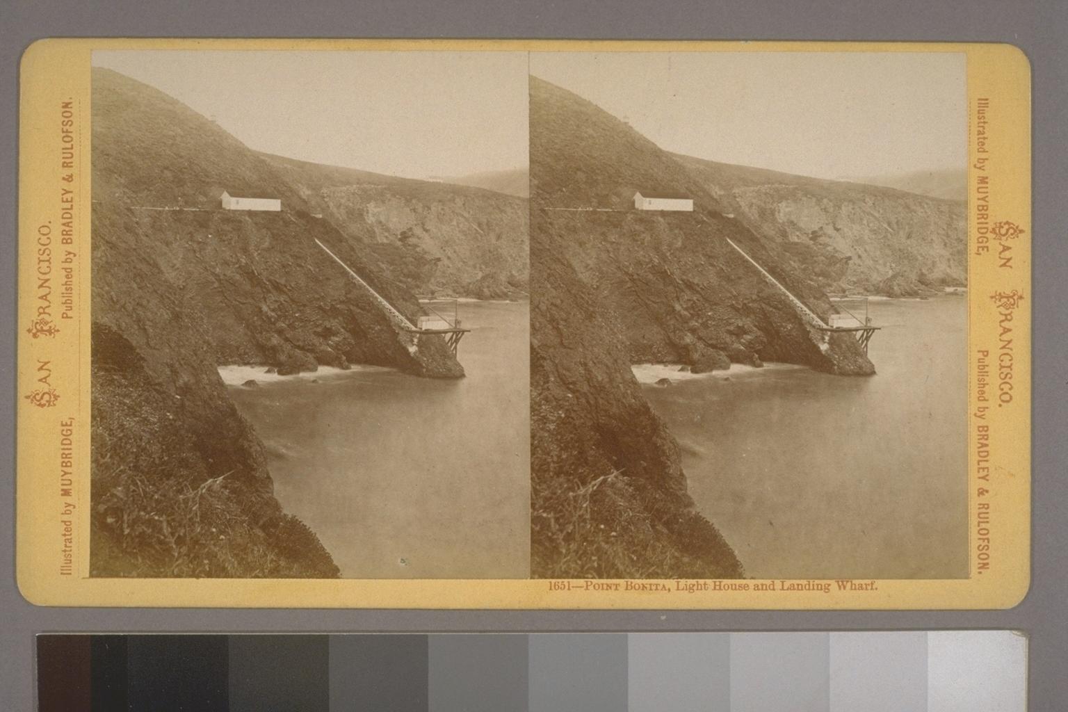
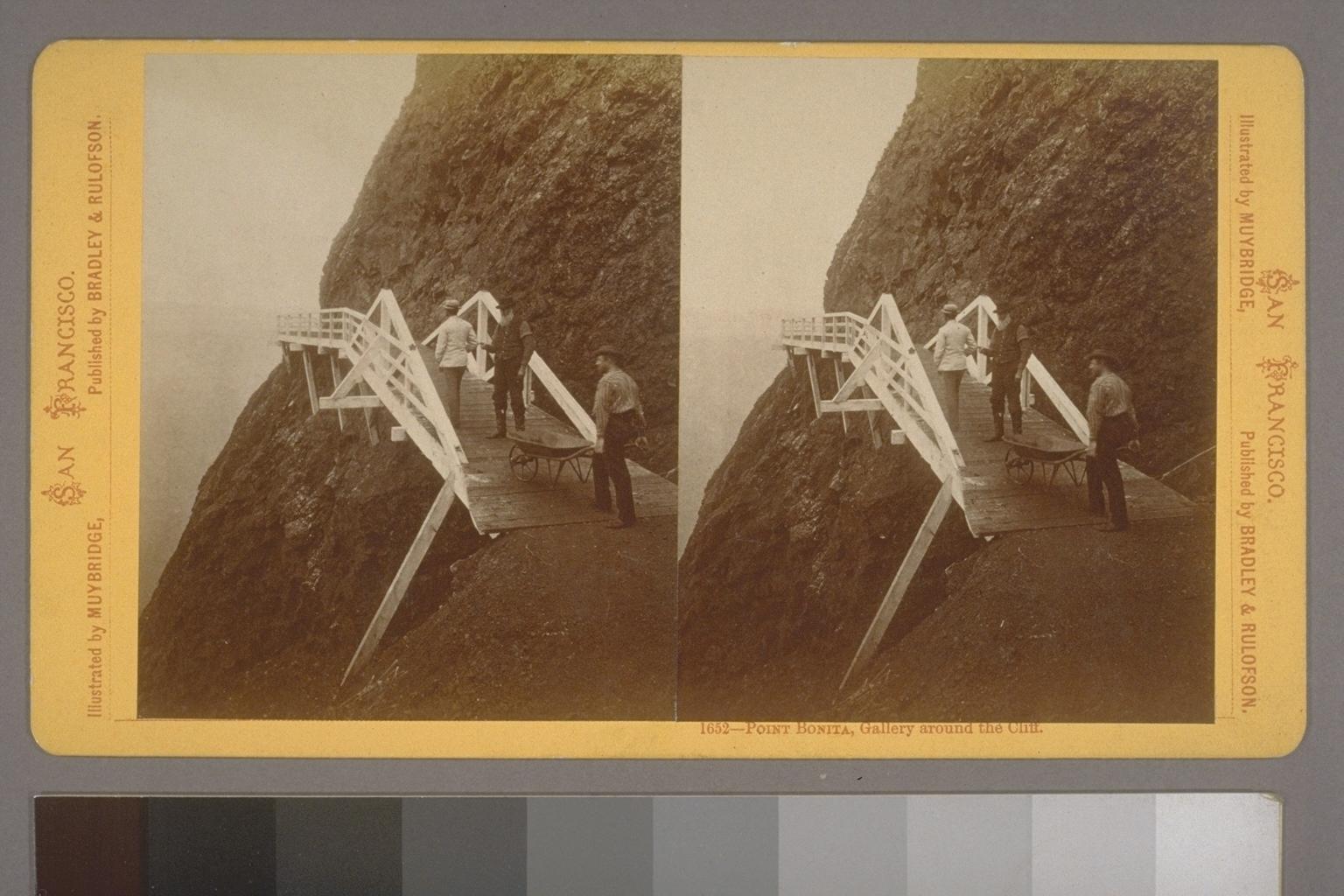
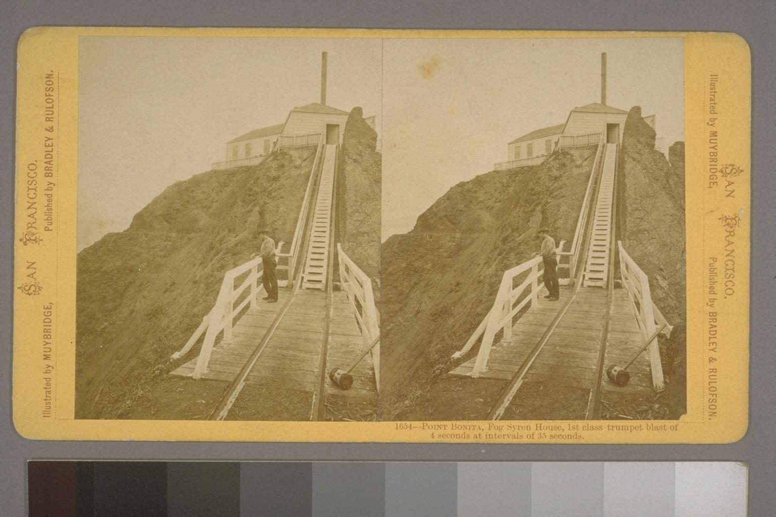
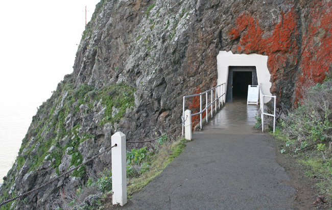
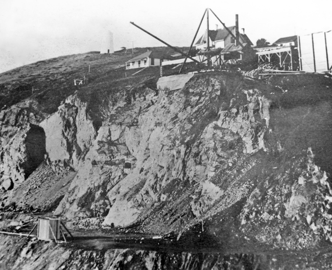
By the 1870s, it was clear that the fog signal and lighthouse should be relocated to the southwestern tip of Point Bonita, where they would be at a lower elevation and better able to serve mariners. A narrow path was carved into the rocky point and a landing platform, with a boom for unloading supplies, was built in Bonita Cove. A railway with a 45-degree incline connected the platform to the path, and a steam-powered winch was employed to pull small cars filled with supplies and construction materials up the track. One section of the rocky face proved impenetrable, and a wooden walkway had to be constructed to skirt this portion of the cliff.
A fog signal commenced operation at the new site in 1872, but two years later, it was undermined by a landslide, and the point was further leveled to provide a more secure site for another signal.
Point Bonita Lighthouse
Photograph courtesy U.S. Coast Guard
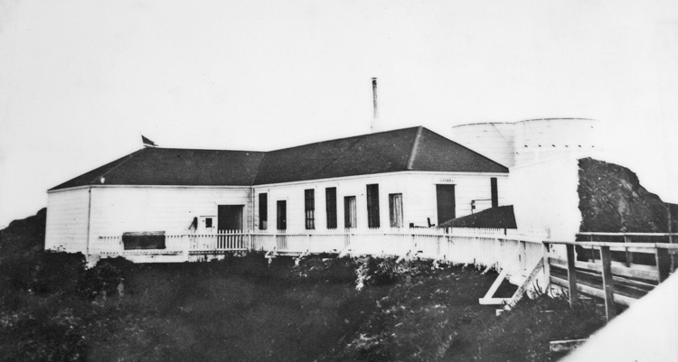
Before building a new lighthouse, access to the point had to be improved. In 1876, Chinese workmen, responsible for the Sierra tunnels of the Transcontinental Railroad, were brought in to dig a 118-foot tunnel through the rock that had previously resisted cutting. The tunnel allowed a railway to be extended from the landing platform west to the area where the keepers resided. Around this time, additional accommodations were built for the keepers next to the original dwelling.
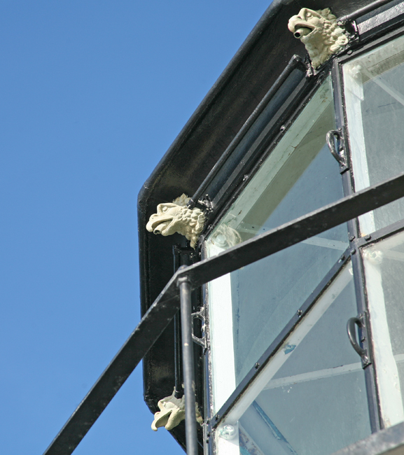
The new lighthouse went into operation on February 2, 1877. Everything from the lower balcony up is from the original 1855 tower, including the Fresnel lens and eagle-shaped rainspouts. At 124 feet above sea level, the new tower was 200 feet lower than its predecessor.
There have been three light signatures at Point Bonita. The first light shone steady, but later a mechanical eclipser was installed to produce an occulting light with a signature of 25 seconds on, 5 seconds off. Currently the light flashes once every three seconds.
On the day after Christmas in 1896, Keeper George D. Cobb was on duty amid rain squalls and a gale wind, when he saw a sailboat capsize off the point, sending its three occupants into turbulent water. Cobb reacted immediately and soon had successfully launched the station’s rowboat. Upon reaching the sailboat, he found two unconscious men in the water and managed to pull them aboard his vessel. The third victim, cut and bleeding profusely, was soon found amongst some nearby rocks, and Cobb succeeded in pulling him aboard as well. All three of the sailors survived the incident, and Keeper Cobb was awarded the Life-Saving Service’s silver medal for his heroic rescue. This accident further punctuated the need for a life-saving station on the northern side of the Golden Gate. Such a station was established on Point Bonita in 1899.
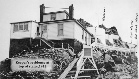
In 1903, yet another fog signal building was built on Point Bonita just below and to the west of the lighthouse, and a new keeper’s residence was eventually built where the former fog signal had stood (at the eastern end of the suspension bridge). Although the keeper assigned to this dwelling no longer had to make a lengthy journey to reach the lighthouse, he was faced with other challenges. Keeper Alex Martin, who lived in the dwelling with his wife and young children, built harnesses to tether his children when they played outside. This foresight was prudent as a daughter, Dorothy, was once found dangling over the cliff in her harness. Unfortunately, no such restraint was provided for the family cat, and it fell to the water below.
The Point Bonita Lighthouse could be accessed by foot until 1940, when erosion cut a gap in the trail near the lighthouse. A breeches buoy was temporarily set up to permit access to the lighthouse until a wooden causeway was built. In 1954, the suspension bridge, which appropriately mirrors the style of the Golden Gate Bridge, was built over the chasm. After a Federal Highway Administration report concluded that the rusting bridge posed a danger to the visiting public, it was closed in 2010. Work on a new suspension bridge of a similar design began in September 2011, and the new bridge allowed public access to the lighthouse to resume in April 2012. The price tag for the work, which was built by Flatiron West of Benicia, was around $1 million.
The original keepers' dwelling was old and decrepit by the 20th century, but the residence would not be replaced until the 1906 San Francisco earthquake brought it crashing down in the early morning hours. Fortunately, the third assistant keeper and the family of keeper Hermann Engel escaped the crumbling building without injury. The original lighthouse, minus its lantern room, had been left standing atop Point Bonita as a daymark. It managed to survive the earthquake, but in 1907 the War Department demanded its removal, claiming it interfered with their purposes on the point.
On December 31, 1979, Point Bonita witnessed an unusual shipwreck. The tugboat Sentinel was pulling two barges through the gate: the Kona, carrying lumber, beer, and paper, and the Agattu, carrying deadly chlorine gas and a potentially explosive fertilizer component.
The tugboat hit unbelievable swells of 35-40 feet, and the towlines snapped setting both barges adrift near perilous rocks. If the Agattu lost its cargo, the ensuing vapor cloud would force the evacuation of the 700,000 residents of San Francisco.
The Kona hit the rocks sending logs and beer into the water. Miraculously, the Agattu landed further north in softer water. The canisters were safely airlifted from the Agattu, but Kona's beer was completely unsalvageable.

Point Bonita was the last manned lighthouse on the California coast. The last keeper, who by that time was living in Coast Guard housing constructed at the former life-saving station, left in April 1981. Point Bonita Lighthouse is now part of the Golden Gate National Recreation Area and is run by the National Park Service. The Coast Guard continues to maintain the light and fog signal.

Mile Rocks San Francisco Bay California

Got this stamp at Golden Gate NRA on a visit in 2011  


The southern side of the entrance to the Golden Gate is dotted with a family of dangerous wave-swept rocks that includes Black Head Rock, Lobos Rock, and Pyramid Rock. The two northernmost, and thus most dangerous to navigation, are Mile Rock and Little Mile Rock, known together as Mile Rocks. Located only 0.4 miles from the closest shore, it seems Mile Rocks are so named because the rocks are one mile south of the main shipping channel leading into San Francisco Bay.
In November of 1889, the Lighthouse Service placed a bell buoy near the rocks. However, the strong currents in the area would pull the buoy beneath the surface of the water and even set it adrift. Frustrated lighthouse engineers concluded that the rocks “must always be a menace to navigation as long as they exist,” as building atop the rocks or dynamiting them below the surface didn't seem practical. Then on February 22, 1901 the City of Rio de Janeiro, inbound from Hong Kong in heavy fog, struck Fort Point Ledge and sunk in just eight minutes. Of the 210 aboard, 128 were lost. The Lighthouse Board concluded that the shipwreck, the worst in San Francisco’s history, might not have occurred if a fog signal could be heard considerably seaward of the ledge.
Mile Rocks Lighthouse
Photograph courtesy U.S. Coast Guard
The tragic wreck provided ample motivation to overcome the obstacles inherent in constructing a lighthouse atop Mile Rock. In 1904, James A. McMahon of San Francisco was awarded the contract to build the lighthouse, and set off with a skilled crew to assess the construction site. After seeing the seagirt rock on which the lighthouse was to stand, the crew promptly quit. A second crew, consisting of deep-sea sailors recruited from San Francisco’s Wharf and thus more familiar with the sea, was assembled, and work began in September of that year. A small schooner, the Rio Rey, was anchored near the rocks and served as floating quarters for the crew.
A good portion of Mile Rock, which measured 40 by 30 feet, was blasted away to provide a level foundation. Next, four-feet thick walls made of steel-reinforced concrete were built to a height of thirty-five feet to form the base of the tower. A cistern and fuel tanks were located within the base, with a heavy door at the base providing access for refueling. Atop the caisson, a three-tiered steel tower, capped by a lantern room, was constructed. Looking at the historic photograph to the right, it is easy to understand why it was called the steel wedding cake.
The first tier of the tower housed the engines for powering the station’s fog signal. The second tier was composed of two stories, with an office kitchen, and day room on the bottom floor, and two bedrooms and a bathroom on the second story. The third tier was used mainly for storage. The caisson and first tier were both oval, while the upper tiers and lantern room were circular. The top tier was used as a storage area, and the lantern room with its crosshatched window panes protected a third-order Fresnel lens, which was first lit during the winter of 1906.
Mile Rocks Lighthouse was always a “stag station”, as there was hardly enough room for the resident four keepers themselves. Couples came up with some innovative methods for maintaining contact. One keeper’s wife would walk the family dog out to Land’s End in the evenings and use a flashlight to signal a greeting to her husband.
Keepers were transported to the tower by boat and from its rocking deck they had to snag the Jacob’s ladder suspended from the tower’s catwalk. In rough seas, the bobbing boat would occasionally knock the keeper off the ladder, before he made the thirty-foot ascent.
In the 1960s, plans were being developed in the Coast Guard to automate Mile Rocks Lighthouse. The upper two tiers of the tower were slated to be removed, and the top of the truncated tower would be used as a helicopter landing pad. San Francisco Supervisor William Blake and the Conference of California Historical Societies both protested the automation plans. The Coast Guard however was determined to proceed with the cost-saving measure. In 1966 and at an expense of $110,000, the Coast Guard dismantled the lantern room and top two tiers of the lighthouse and constructed the landing pad. The San Francisco Maritime Museum tried to acquire the top forty feet of the lighthouse and place it on display at the foot of Hyde Street, but as saving the upper portion of the tower would have added $87,000 to the $110,000 contract for refurbishing the lighthouse, the living quarters were scrapped.

 Although the base of the tower is now painted with colorful orange and white bands, the beauty of the structure was greatly compromised when the tower was decapitated. One can only speculate at what role this truly unique tower would have today, if it had remained intact. One can view still view one of the more attractive remnants of the Mile Rocks Lighthouse, as its lens is currently in use at the Old Point Loma Lighthouse in San Diego.

Point Reyes Lighthouse, California

The walkway to the light was closed for construction when we were here, but we got the stamp anyway.   


Considered one of the foggiest and windiest stations in the U.S., Point Reyes inspired Lightkeeper Edwin G. Chamberlain to record the following prose in the station’s logbook:
Solitude, where are thy charms that sages have seen in thy face?
Better dwell in the midst of alarms than reign in this horrible place.

So city, friendship, and love Divinely bestowed upon man,
O’had I the wings of a dove, How I would taste you again.
In 1595, the Spanish galleon San Agustin sought shelter from a storm. Thinking Point Reyes was an island rising from the sea, the captain ran his ship aground in Drakes Bay, becoming the first recorded shipwreck on the west coast. Despite many subsequent shipwrecks, the point would remain unmarked for 275 years.
Point Reyes was named by Sebastian Vizcaino, who sailed along the California coast in 1603. On January 6, the twelfth day of Christmas, Vizcaino passed the peninsula and called it "Punto de los Reyes," for the Feast of Three Kings.
A lighthouse was assigned to Point Reyes in 1855, but construction was delayed for fifteen years while the Lighthouse Board wrangled with landowners over a fair price for the land. Fourteen shipwrecks occurred in the years the price was under dispute.
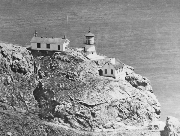
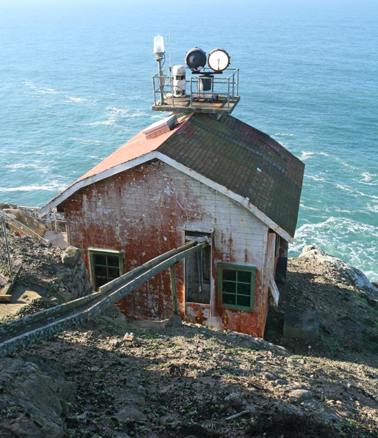
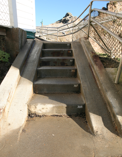
The original plan for the Point Reyes Lighthouse was a two-story dwelling with an integral tower, much like those built at Point Pinos and Old Point Loma, which would be located on top of the bluff at Point Reyes. However, a lesson was learned from Point Bonita that fog could obscure an elevated light, and the plan was revamped to place the light 275 feet lower. Two terraces were carved out of the cliffs: one at 100 feet above the sea for the fog signal building and a second one 150 feet higher for the light tower. A 300-step wooden stairway was built into the cliff to reach the tower from the top of the bluff, and 338 more steps were required to reach the fog building.
raph courtesy Library of Congress
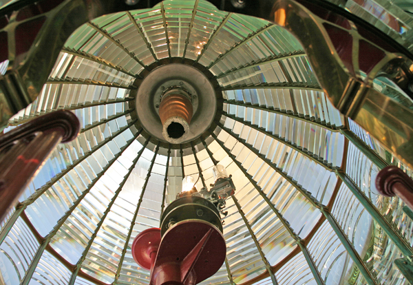
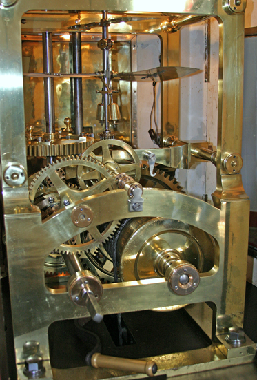
The lighthouse is a sixteen-sided, 37-foot, iron tower, a twin of Cape Mendocino, and was anchored to the cliff with large bolts. It still shelters the first-order Fresnel lens manufactured by Barbier and Fenestre that was first lit on December 1, 1870. The lens consists of twenty-four bull’s-eye panels held in place by a brass frame, and when revolved at the rate of one revolution every two minutes, it produced a white flash for mariners once every five seconds.
A two-story, spacious dwelling was built for the keepers on top of the bluff where the present park service housing is located. Nearby, a huge cistern and associated concrete rain catchment basin were constructed to provide water for the keepers and the thirsty steam fog signal. The collected rainwater was not always sufficient for the station’s needs, and one year a local rancher had to haul over twenty thousand gallons to the station to help mother nature fill the cistern.
Point Reyes was not an envied lightkeeper assignment. 40 mph winds are common, and gusts have been reported as high as 133 mph. Fog is also a frequent guest. It is not unusual to have over 2,100 hours of fog annually. One time, the keepers recorded 176 hours of continuous fog (7 days, eight hours). 24,640 lbs of coal were used in that week alone to keep the fog signal blowing. Over a thirty-one-year period, Point Reyes had the highest annual average hours of fog on the west coast at 1,337 hours, or fifteen percent of the time. In 1887, the San Francisco Chronicle reported, "When the storms are their worst, spray dashes up two hundred feet… [the keeper's] only safety is in crawling on hands and knees up and down … the stairs."
The incredible weather at Point Reyes attracted the presence of two other governmental entities as well. In 1901, the Weather Bureau built a station at the head of the stairs leading to the lighthouse. Storm warning flags were flown from the summit of the point to alert mariners of approaching foul weather. The Life-saving Service opened a station on Point Reyes Beach, just two and one-half miles north of the lighthouse, in 1890. This station was in operation until the Coast Guard opened a lifeboat station on Drake’s Bay in 1927. That same year, modern communications eliminated the need for the weather station at Point Reyes, and the building was subsequently used as a dwelling by the lightkeepers.
In 1927, Keeper Fred Kreth attempted to save three fishermen whose boat had hit the rocks at the point and left them stranded at the bottom of the cliff. Kreth rappelled 200 feet down the cliff, and when he could go no further, he untied the rope around his waist, braced himself on a thin ledge, then threw the rope down 50 more yards and somehow pulled all three to safety. The Coast Guard had also responded to the incident, but the surf proved too high for a sea rescue. Frustrated, the Coast Guardsmen returned to their station and tried to reach the stranded fishermen by land. One Coast Guardsman descended down the rocky face to the beach where the fishermen were stranded only to find it deserted. The three missing fishermen were soon found at the lighthouse receiving care from Keeper Kreth.


Photograph courtesy U.S. Coast Guard
Numerous keepers served at the Point Reyes Lighthouse since it was typically staffed by a head keeper and three assistants. The first head keeper was John C. Bull, and the last keeper serving under the Lighthouse Service was Gustav Zetterquist, who arrived in 1930 as an assistant keeper and remained until 1951. This wasn’t the longest tenure at the station as Paulus Nilsson signed on as first assistant in 1897, became head keeper in 1909, and served until he suffered a fall on February 18, 1921 and died three days later. Tom Smith was the last officer-in-charge for the Coast Guard at Point Reyes.
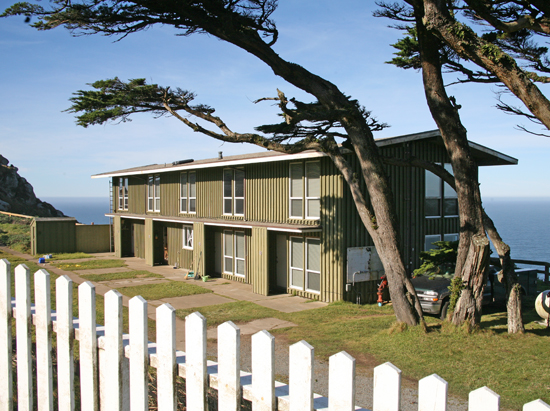
By 1934, the fog signal had been relocated from the lower terrace to a new structure built just below the lighthouse. Electricity came to the lighthouse in 1938, and concrete steps were built into the cliff in 1939. The original keeper’s dwelling was razed in 1960, and a four-unit apartment was built in its place. The station was automated on June 12, 1975, but the beacon tower, clockwork mechanism, and original Fresnel lens were left intact. All of the station's eighty-two acres save the tower and keepers' residence were turned over to the National Park Service to become part of the Point Reyes National Seashore. The park service opened the station to the public on August 15, 1977.
In 2003, major renovation work was done at the station. Costing $1.2 million and taking six months to complete, the project included repairing the existing buildings and replacing the 300+ steps leading to the tower.

Point Reyes is maintained by the National Park Service and is part of the Point Reyes National Seashore. Spring finds Point Reyes wrapped in a beautiful green Scottish landscape. If you come between January and April, chances are you'll see a few grey whales spouting away in their annual Alaska-Mexico migration.